


Field area
| 13 de novembro de 2023
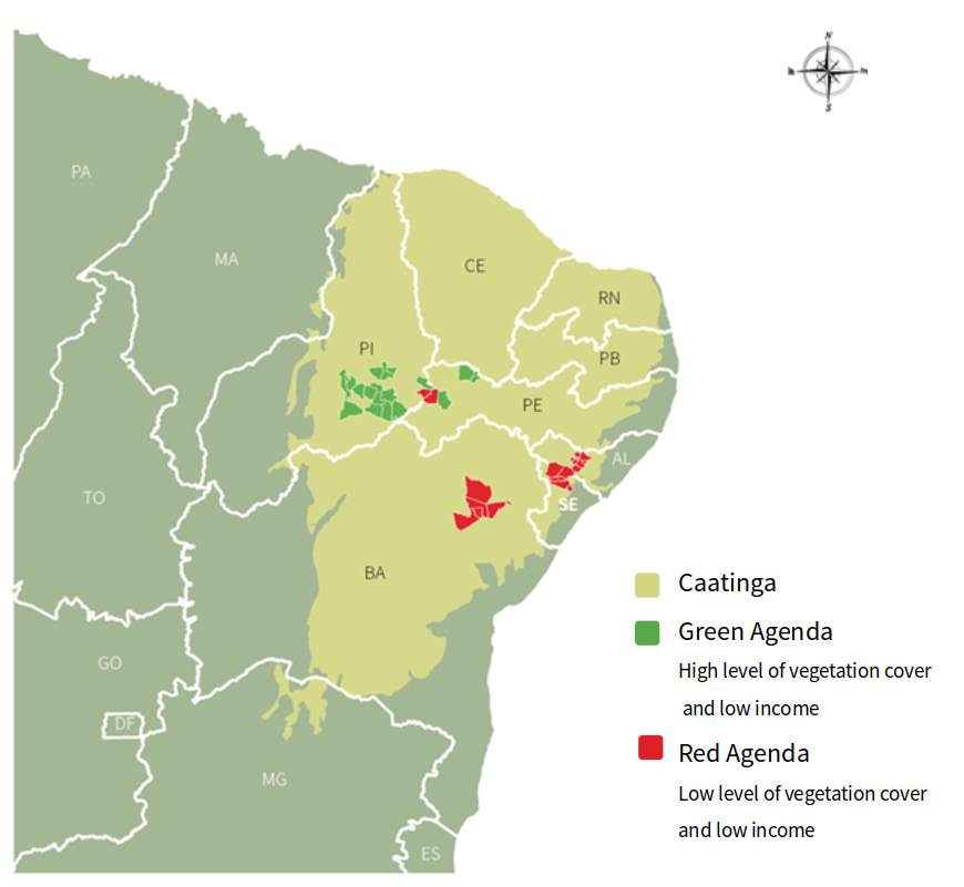
The Caatinga biome is located in Northeast Brazil, the region with the lowest Human Development Index (HDI) in the country. It concentrates 18% of the country’s poorer rural population and 10% of the poor national population. Near 60% of the municipalities are under the poverty line of US$1,25 per capita per day.
Agriculture plays a key role in the Caatinga biome. Nearly 12% of Brazil’s population live in the region and depend on agricultural activities. Approximately 32% of the 5 million farms in Brazil are located in the Caatinga. Traditional agricultural practices, such as the use of slash and burn and overgrazing, are common, causing land degradation and increasing desertification. The native vegetation of the Caatinga has been transformed by deforestation, with geoprocessing monitoring indicating that 45% of the biome has been deforested and degraded.
As a result, the Caatinga has become the third most degraded biome in Brazil after the Mata Atlântica and the Cerrado and will be the more severely impacted biome in Brazil by the change in temperature. On the other hand, the studies also demonstrate that agroforestry systems in the Caatinga have the potential to store approximately 11,72 tons of CO2.